Temperate mid-continental climate. Yearly mean temperature is 13C with a range of extremes from 6 to 19C. The January mean temperature is -3C (range -9 to 3C) and the July mean is 27C (range 20 to 33C). Annual precipitation is 835 mm of which about 75% occurs in the growing season. Mean snowfall for January is 150 mm with an annual total of 521 mm. Mean annual windspeed is 5 meters per second from the south.
Tallgrass or bluestem prairie is one of the major ecosystem types of the conterminous United States (exceeded in area only by eastern deciduous forest). Undisturbed examples of tallgrass prairie are rare because this ecosystem type has been extensively converted to agroecosystems.
Konza Prairie is representative of the Flints Hills, a dissected upland with hard chert- and flint-bearing limestone layers. The ridges are usually flat with shallow, rocky soils, whereas the larger and wider valleys have deep permeable soils. The steep-sided hills are characterized by exposed Permian limestone and shale strata that prevented cultivation.
When acquired in the 1970's, the majority of Konza Prairie was dominated by native prairie species, especially big bluestem, indian grass, little bluestem, and switchgrass. Lowland areas with deep soils now have patches of these and other tallgrasses that grow to 2 to 3 m by late summer. Gallery forests on lower Kings Creek are dominated by bur and chinquapin oaks with green ash, hackberry, elm, and black walnut often common. The KSU herbarium contains more than 450 species of vascular plants collected from Konza Prairie. Woody plants have been mapped according to species and size on some portions of the site. Species lists have also been developed for a number of animal groups including birds, mammals, reptiles, amphibians, and aquatic invertebrates.
Konza Prairie is managed to provide an array of burning and grazing (especially bison) treatments to facilitate research to evaluate the effects of fire and grazing on plant composition, primary production, consumer density and diversity, nutrient dynamics, soil chemistry, and hydrology. This natural prairie also serves as a reference site from comparison to manipulated agricultural systems.
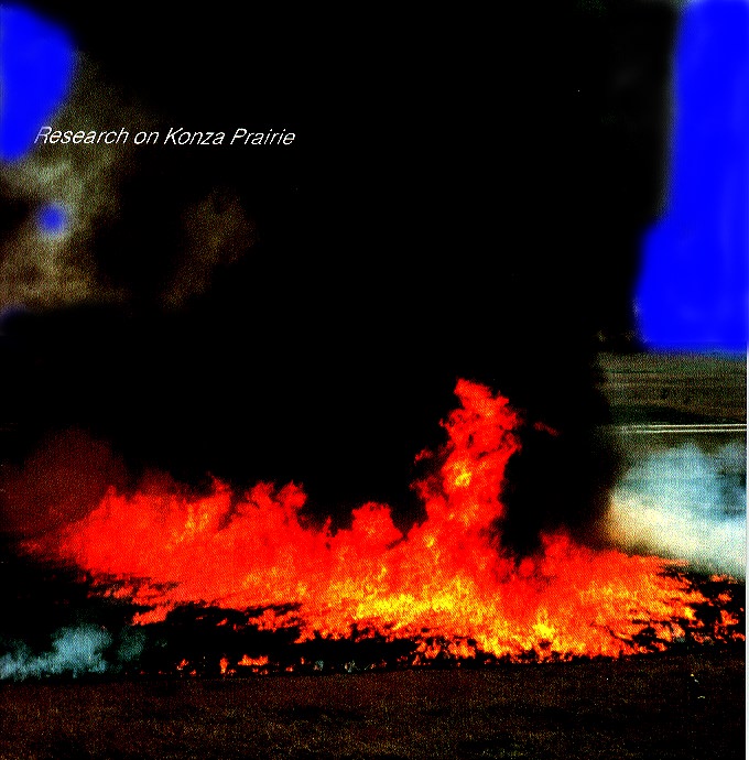
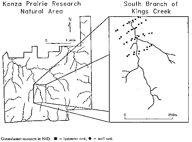
Fire, started by both lightning and aboriginal man, influenced patterns and processes in the tallgrass prairie. To understand these effects, a series of spring burning treatments (primarily areas burned at 1,2,4,10, and 20 year intervals) are maintained on watershed units. (Fig.1). These experimental burns are conducted in April before the dominant warm-season grasses begin active growth. Treatment boundaries follow watershed divides to facilitate analysis of hydrologic and nutrient responses to fire and frequency of fire. An extensive soil water/ground water monitoring system has been installed by the USGS on one of these watersheds. (Fig.2).
Bison were introduced into a fenced area of nearly 500 ha encompassing several different burn treatments in 1987. The area affected by bison was enlarged to 1100 ha in 1991. Bison, free-ranging within the fenced area, are able to choose between burned and unburned prairie and among sites representing an array of topographic/physiographic conditions. Cattle grazing still occurs sporadically on parts of Konza Prairie but not on the primary LTER research watersheds.